50 Mile Course Description
The Course starts on the road only 100 yards from the Registration Tent. You head down the paved Resort entrance road to Rte. 44. Sharp left, followed by an equally-sharp right turn onto unpaved Brook Rd. Now after 4/10 mi. turn left to start a 2.3 mile stretch of climbing and rolling dirt, then gravel roads to the first aid station.
Now you’ve got about 2 miles of uphill on snowmobile ATV trail. Then 1.5 of road before your next aid station, followed by 4 more miles of trail to Skunk Hollow.
After the aid station at the Skunk Hollow Tavern (@12 mi.), the next 8 mile stretch includes less than 2 on trail. Enjoy it because it’s going to change. A key feature of this course is the fact that it pretty much alternates between road and trail and gives you plenty of hills to deal with.
At mile 20 you’ll encounter 1812′ Garvin Hill, the highest point in Hartland, and wind up over and around it before heading back south on more trails and gravel roads. This includes a long descent of Densmore Hill Road, part of the revised 100 mile course, and then back up an equally long hill trail. At about 28 miles you come out onto Reeves Rd., where the 50K route hooks back in. Now there’s over 2 miles of fairly decent terrain road, passing Smoke Rise Farm, but, of course, followed by more canopied trail. Be aware that the great majority of the trails on the course are quite ride able / run able with little in the way of rocks or roots. Almost all are part of the Green Mountain Horse Association trail network and are well maintained.
After Greenall’s Aid Station at 31.9 mi there is another brief road segment; followed by a weaving route through the woods and meadow around Blood Hill, some steeps near the 100 finish meadow and a climb over a 1,600′ attention getter. In the last 11 miles the only road pieces you’ll be seeing will be one, then a half and then a quarter mile long, respectively.
You can pick up your pacer at Aid Station #9 Stones (approx. mile 42), but they have to ride on the shuttle to get there. The rest of the way is mostly trail, which gets progressively tougher when you enter onto the cross country network after the last aid station (Johnson’s), with about 3 miles to go. In the last mile you’ll be crossing the lower Ascutney Alpine slopes on mostly grassy trail, with some side pitch, mostly to the left.
It’s worth all the effort you’ve expended when you can finally look down at the finish line by the base lodge and pound/pedal your way down a quarter mile of blessed downhill. For those familiar with the Vermont100 course, the 50 Mile is basically superimposed on the last third but actually shares less than 10 miles of it. About 2/3 (67%) of the 50 Mile course is on trails or jeep (unimproved) roads. 30% is on smooth, rolling gravel roads and 3% is on pavement. It is a challenging course, with good footing/traction, plenty of hills and classic Vermontscenery that will be a welcome distraction.
The total vertical elevation for the 50 Mile race is about 8,900 feet.
Note, the following are the approximate percentages:
Gravel Rd./Trail or Jeep Rd./Pavement
50 Mile: 30% , 67% , 3%
50 Km.: 37%, 58%, 5%
50K Course Description
If you’re looking for flat and fast, this isn’t for you. If you are looking for something that isn’t quite so challenging as the 50 mile, listen.
The Course starts on the road only 100 yards from the Registration Tent. You head down the paved Resort entrance road to Rte. 44. Sharp left, followed by an equally-sharp right turn onto unpaved Brook Rd. Now after 4/10 mi. turn left to start a 2.3 mile stretch of climbing and rolling dirt, then gravel roads to the first aid station.
Now it’s time to really get to work, when you enter onto 2+ miles of snowmobile-ATV trail which is fairly steep at the outset. When you exit the trail onto gravel road, at about mile 6, you take a sharp left, whereas the 50 milers went right to tackle 19 miles of stuff you don’t have to worry about.
You’ll get to your second aid station (2K-Ralph’s) shortly, followed by 3+ miles of gradual uphill smooth road. You may see 50 milers joining in from a trail on your right. They’ll be with you for ¾ mile until you get to the Margaritaville aid station, where you turn left onto trail again, and they keep going straight. After another ¾ mile you’ll join the 50 milers again, from which point your course to the finish is the same as theirs.
After the Greenall’s aid station at 13.4 mile there’s another brief road segment, followed by a weaving route through the woods and meadow around Blood Hill. A few more steeps near the 100 mi. Meadow, and a climb over a 1,600’ attention-getter. In the last 11 miles the only road pieces you’ll be seeing will be one, then a half and then a quarter mile long, respectively.
From Stones aid station, the rest of the way is mostly trail, which gets progressively tougher when you enter onto the cross country network after the last aid station (Johnson’s), with about 3 miles to go. In the last mile you’ll be crossing the lower Ascutney Alpine slopes on mostly grassy trail, with some side pitch, mostly to the left.
It’s worth all the effort you’ve expended when you can finally look down at the finish line above the base lodge and pound your way down the last blessed quarter mile.
Almost 2/3 of your total course is trail, most of which provides fairly decent footing, with little in the way of rocks or roots. Eight miles of it is on segments of the 100 Mile course.
The total vertical for the 50 Km is about 5,600’.
Race Weekend Sheet
Directions to Ascutney Mountain Resort
Ascutney Mountain Resort is 10 miles from exit 8 or 9 off Interstate 91
Map Of race area
Race Parking
Please park at the base lodge (and other designated spots only.) Walk or bike down to the race office-BIG TENT-in the Cunningham building lot (look for signs). Please use parking lots only for parking!! To get to the Base Lodge when turning off Route 44 continue straight (do not take turn). The parking lot will be on your right. If you park on the grass you will be towed!
Vehicles On Course
Participants must register ONE vehicle at the Information Table to be allowed on course. Relay Teams-one vehicle per team. Please stay off the actual race course as much as possible. You will be given Handler/Crew directions to designated Aid Stations at the Info. Table.
Drop bags
Drop bags will be measured and weighed at the Information table also. See Drop Bag 101
Course Information:
Mountain Bike Guidelines and Course Description
Runner Guidelines and Course Description
The race cut off time for everyone is 6:30 p.m.
Vermont 50 Relay Team
Relay Team Information
Relay Race Areas-You must Have A Parking Permit to Drop off Your Team Members-one vehicle per team!
Mileage breakdown:
12.3 Miles Start to Skunk Hollow
17.9 Miles Skunk Hollow to Greenall’s
19.8 Miles Greenall’s to finish
Relay runners are responsible for getting themselves to the exchange points. Only one vehicle per team will be allowed, and it must have an official Parking Permit, which must be obtained at the Information Desk.
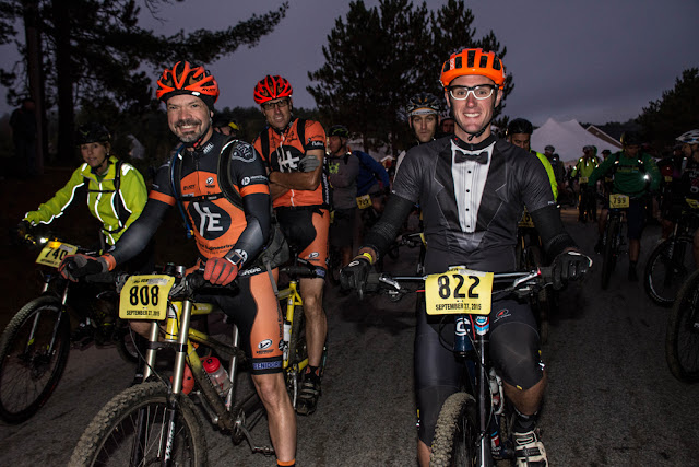
Mountain Bike Race
Mountain Bike Categories:
Novice – entry level or first time competitor.
Sport – intermediate competitor
Expert – very advanced competitor
Mt. Bike Age Groups
12- 17 Junior
18 – 26 Senior I
27 – 34 Senior II
35 – 44 Veteran
45 – 54 Master I
55 – 64 Master II
65 and up Master III
Biker age as of 12/31 race year
Additional Mt. Bike Classes:
Clydesdale – Novice (min. weight 200 lbs)
Clydesdale – Sport (min. weight 200 lbs)
Tandem
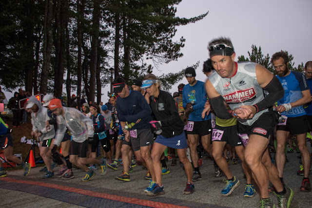
Endurance Run Race
Runners Male and Female in each category and class
Runner Age Groups:
12-19
20-29
30-39
40-49
50-59
60-69
70-and up
Runners age is what they are on race day


